


MundoGEO Connect 2025 exhibition will feature companies from across the entire Geotechnology sector production chain, as well as government institutions such as the National Institute of Colonization and Agrarian Reform, the Brazilian Institute of Geography and Statistics, the Ministry of Defense, the Ministry of Agriculture and Livestock, the Secretariat of the Union’s Heritage, among others.
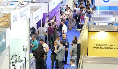 The MundoGEO Connect 2025 fair will take place from June 3rd to 5th at Expo Center Norte – Pavilhão Azul, in São Paulo (SP). Highlights include courses, seminars, and free activities on a variety of topics, including ArcGIS, QGIS, Google Earth Engine, Digital Twins, BIM, and their applications in agriculture, forestry, urban areas, security, and the environment, as well as the 1st Meeting of Aerial Survey Service Providers.
The purpose of the MundoGEO Connect event is to bring together manufacturers and importers of drones and geomatics equipment, embedded technology, data processing platforms, satellite or aircraft solution providers, system developers and service providers, regulatory agencies, universities, startups, and public and private users of these technologies.
The 2025 edition offers courses, seminars, and a technology fair, showcasing reality capture solutions (using satellites, aircraft, drones, and fixed and mobile ground stations), image processing using artificial intelligence, and information visualization and analysis using 3D resources such as Virtual Reality (VR), Augmented Reality (AR), and digital twins.
This event is aimed at service providers and users of these technologies in the areas of Agriculture, Forestry, Environmental, Smart Cities, Logistics, Defense, Energy, Highways, Railways, Ports, Airports, Mining, Oil & Gas, Security, Telecommunications, Civil Construction, and others.
“At the exhibition, the highlight are companies providing mapping and geographic analysis services, as well as distributors of geomatics equipment, such as GNSS receivers, total stations and Lidar sensors for capturing reality.”,
comments Emerson Granemann, CEO of MundoGEO.
See the 2025 exhibition floor plan:
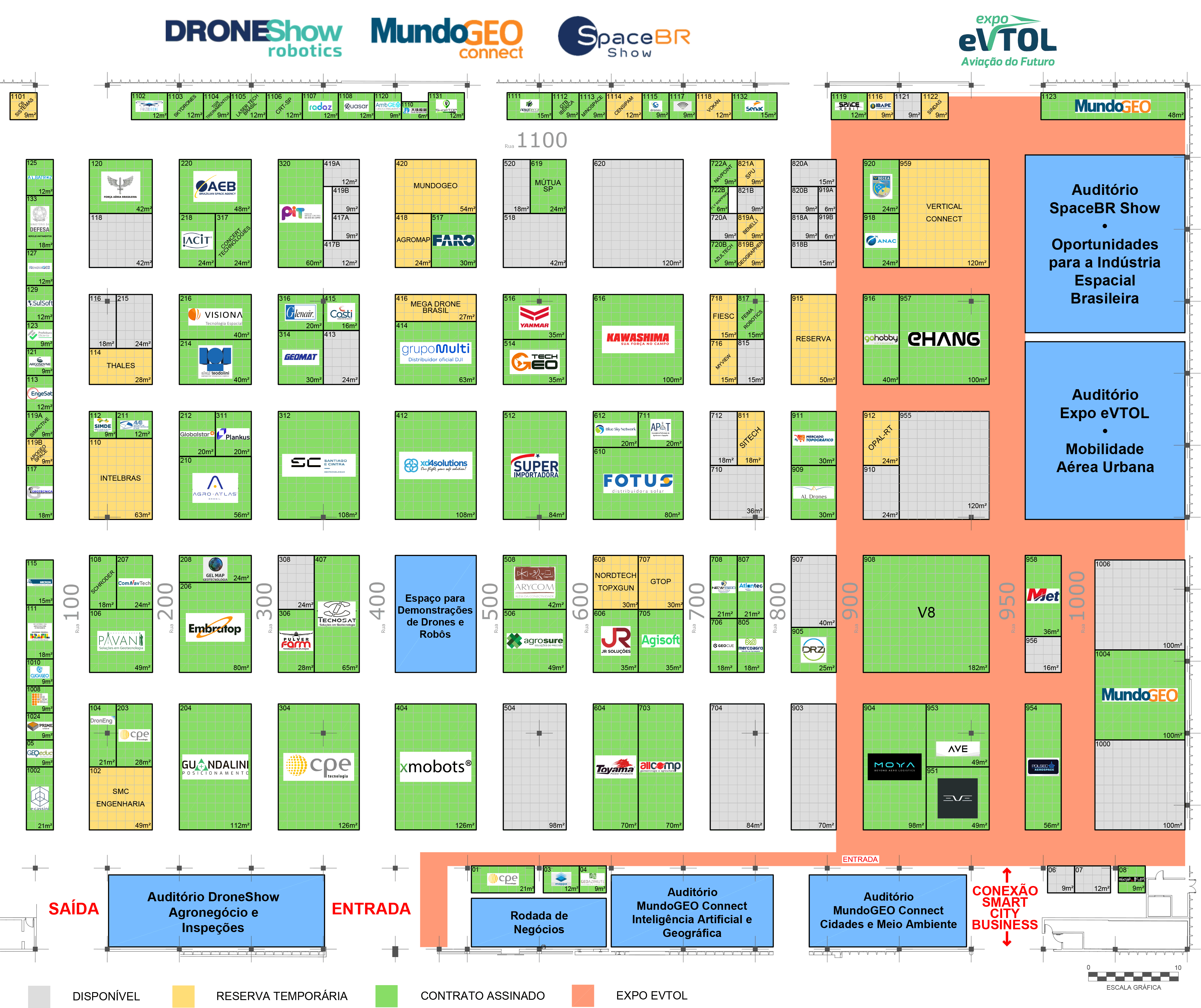
See the full list of exhibitors
Seminars, Courses and Forums
The event’s activities include seminars designed to provide participants with strategic information for decision-making. They cover the use of technologies and their applications in agriculture, forestry, the environment, municipal management, advanced mobility, and more. Featuring speakers and panelists who are experts in their fields and recognized in the market, the seminars offer participants the opportunity to learn about the latest trends.
The courses offered at the event focus on providing comprehensive training in geotechnology and drones. They cover topics such as digital mapping, geographic information systems (GIS), remote sensing technologies, and drone applications. Taught by recognized industry experts, the courses offer participants the opportunity to deepen their knowledge, learn about the latest industry innovations, and develop essential skills for their professional careers.

With the aim of discussing the current state and identifying trends in the space and advanced air mobility sectors, two forums will be held involving government agencies, companies, academia, and users.
Business Roundtable
At the Business Roundtable held at the fair, exhibiting companies in the sector will have the opportunity to participate in pre-scheduled 20-minute meetings, according to the supply and demand of interested parties, increasing the possibility of generating qualified leads and partnership and business opportunities in the drone, geotechnology, space and advanced air mobility markets.

Simultaneously with MundoGEO Connect 2025, three other technology events will be taking place at the same location: DroneShow Robotics, about drones and mobile robotics; SpaceBR Show, about the space sector; and Expo eVTOL, about Future Aviation. The adjacent pavilion will host Smart City Business Brasil, dedicated to smart cities.